My objection to Glen Lednock Wind Farm
Spotlighting the inappropriate exploitation of natural capital
Preamble
I wondered whether to share the contents of my objection, which will appear on the Scottish Government’s Energy Consents Unit website, when they get round to uploading all the ‘representations’ they have received about the application for Glen Lednock Wind Farm on Invergeldie Estate in Perthshire (Ref. ECU00004966).
In several recent posts I have written about the ‘green’ lairds, whose city money has been buying up traditional sporting estates in the race to capitalise on the new market in carbon credits. In that context, I thought that this objection usefully highlights many of the issues that arise when those developers have little knowledge or appreciation of the landscapes they have acquired or the communities who live on and around them.
Before you read it, a caveat. The Environmental Impact Assessment Report (EIAR) provided by Low Carbon to support this application for consent to build the wind farm runs to 193 documents, many scores of pages long. I have only homed in on selected ones and may have misinterpreted them in places. I am an ordinary member of the public and the short timescale given for representations meant that it was impossible to examine them all carefully. Even an expert in this field would need months to do so thoroughly.
And a reminder, Low Carbon are a sister company of Oxygen Conservation, who bought Invergeldie Estate a couple of years ago. Both are wholly owned subsidiaries of Oxygen House, as I described in the post: When greenwashing leaves a stain.
This is my personal – and at times emotive – response to what is proposed and how it has been justified. I also contributed sections to a more measured 40-page objection submitted by the Save Glen Lednock (SGL) group. I gave an update on the SGL campaign in the post: Are wild spaces and communities to be sacrificed on the altar of AI?
My objection isn’t as long as that document, though you may find this a lengthy post. So I hope the headings will enable you to skim read if you want to focus on the subject areas that catch your interest.
Because this post includes lots of photos, your email provider may truncate it. In that case click the link "View entire message" to view the whole post.
1. Landscape and Visual impact
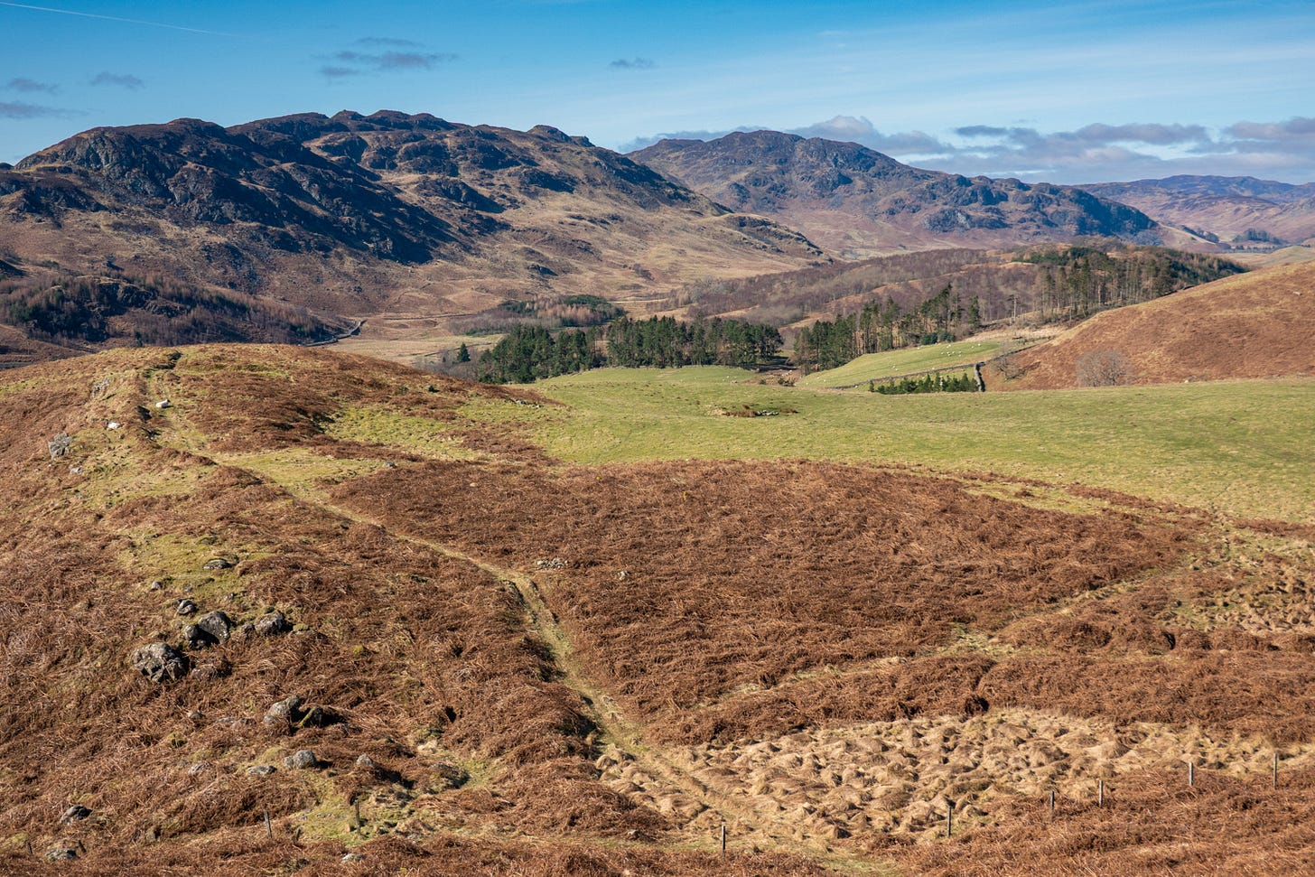
My assessment is that Low Carbon’s Environmental Impact Assessment Report (EIAR) vastly understates the impact that visual impact on the landscape, especially designated areas, in order to rate them as ‘localised’ and therefore acceptable under National Planning Framework 4 (NPF4).
I believe that the development of Glen Lednock Wind Farm would damage the character and qualities of nearby of Loch Lomond and The Trossachs National Park (LLTNP). And also that it would heavily impact the views, and therefore the value, of the National Scenic Areas (NSA) to south and north: River Earn NSA and Loch Rannoch and Glen Lyon NSA.
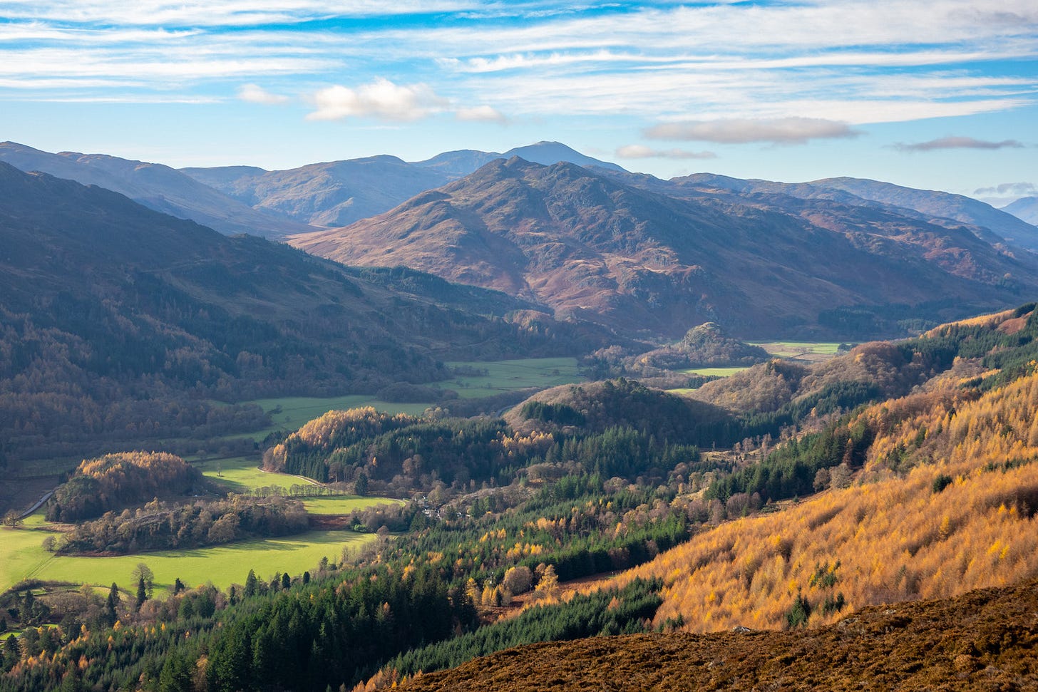
The proposed wind farm site on the upper west side of Glen Lednock stands on the southern edge of the Highlands, above the dramatic and highly scenic line of the Highland Boundary Fault; it would disrupt classic views of that major landscape feature from all around. The 19 planned 180-200m turbines would be placed on a site at an altitude of 500-700m, giving a cumulative height of the blade tips of between 680-900m.
The visualisations provided are of limited value as they miss many favourite places that will have views of the wind turbines. Also, they appear to show a 180-degree view of the landscape, which is not how the human eye works. Therefore these visualisations make the turbines look much smaller in the landscape than they will appear to the viewer in reality. Our main field of vision is usually taken as 50-degrees, but when we focus on an element of a view – perhaps drawn by the movement of turbine blades – what our brains see and process is much narrower than that.
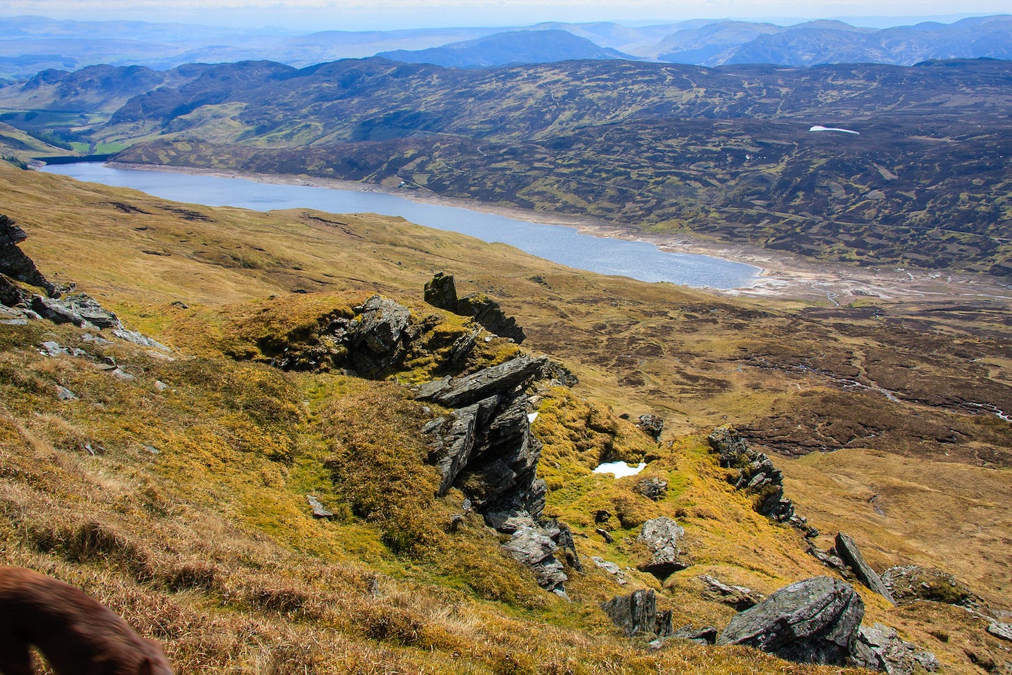
When combined with the proposal for the adjacent Glentarken Wind Farm, which is also at the planning application stage, the cumulative impact would be even greater. These two projects are essentially one scheme when seen on a map and would appear as a single wind farm of 31 turbines when viewed in the landscape. As someone who knows these landscapes well and who have explored them from all angles, I strongly disagree with the conclusion that the combination “would not lead to an increase in the level of significant impact reported for Glen Lednock with the operational baseline for the majority of landscape and visual receptors assessed and for SLQ of River Earn (Comrie to St Fillans) NSA, Loch Rannoch and Glen Lyon NSA or LLTNP. “
Many residents of Comrie, including me, moved to upper Strathearn attracted by its beautiful rural landscapes and extensive opportunities for outdoor recreation. We are walkers, cyclists, hill runners, mountain bikers, rock climbers, wild swimmers, birders, photographers and wildlife lovers. We feel that the extraordinary qualities of our open spaces are threatened – both for ourselves and the many visitors who come to enjoy them.
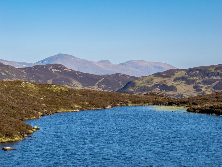
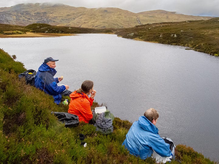
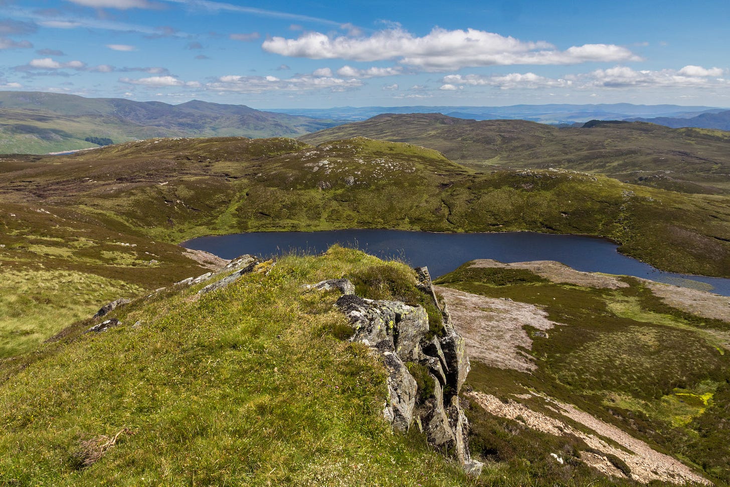
I delight in upper Glen Lednock as an area where I can roam all day in peace, rejoicing in its ‘wild’ character and rugged landforms, while connecting with nature. Several special places within the turbine site would be wrecked by the giant structures and associated tracks, construction compounds, and borrow pits (i.e. quarries). These places include Creag Ruadh, a superb viewpoint where I have bivvied out to enjoy the night sky and sunrise over Ben Chonzie, as well as the delightful lochan cradled on its east side. Another is Lochan Mhaoil na Meidhe, perched on the ridge between Gleann Mathiag and Loch Lednock Reservoir. I was originally introduced to it by the Strathearn Ramblers as the ‘infinity loch’, looking toward Ben Lawers. It is a well-loved picnic spot.
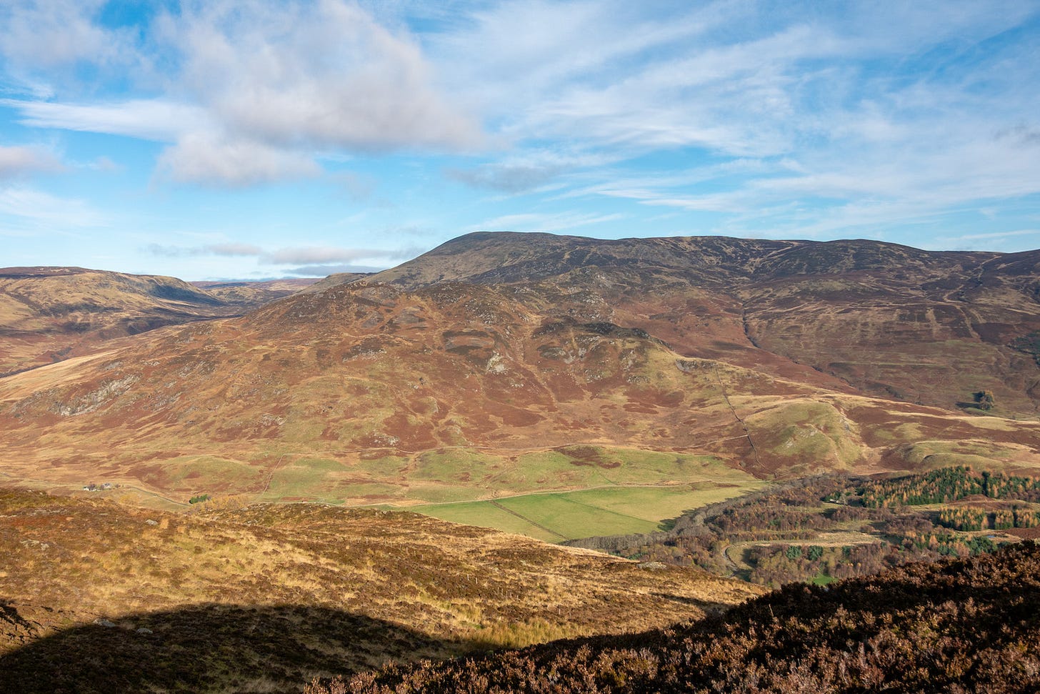
The proposal includes a hugely-damaging access road along the eastern side of Glen Lednock, as well as compounds and borrow pits that will disfigure the landscape. The open, middle section of the glen is one of the most scenic areas of Strathearn and the proposed access road would form an ugly scar all the way up the glen, visible from the road and the surrounding hills.
On top of my own heartfelt dismay at the prospect of beloved landscapes and views being wrecked, I anticipate that the impacts of construction and the sight of remarkably tall turbines in this peaceful landscape will deter visitors and tourists to the area, damaging it economically.
2. Cultural Heritage impact
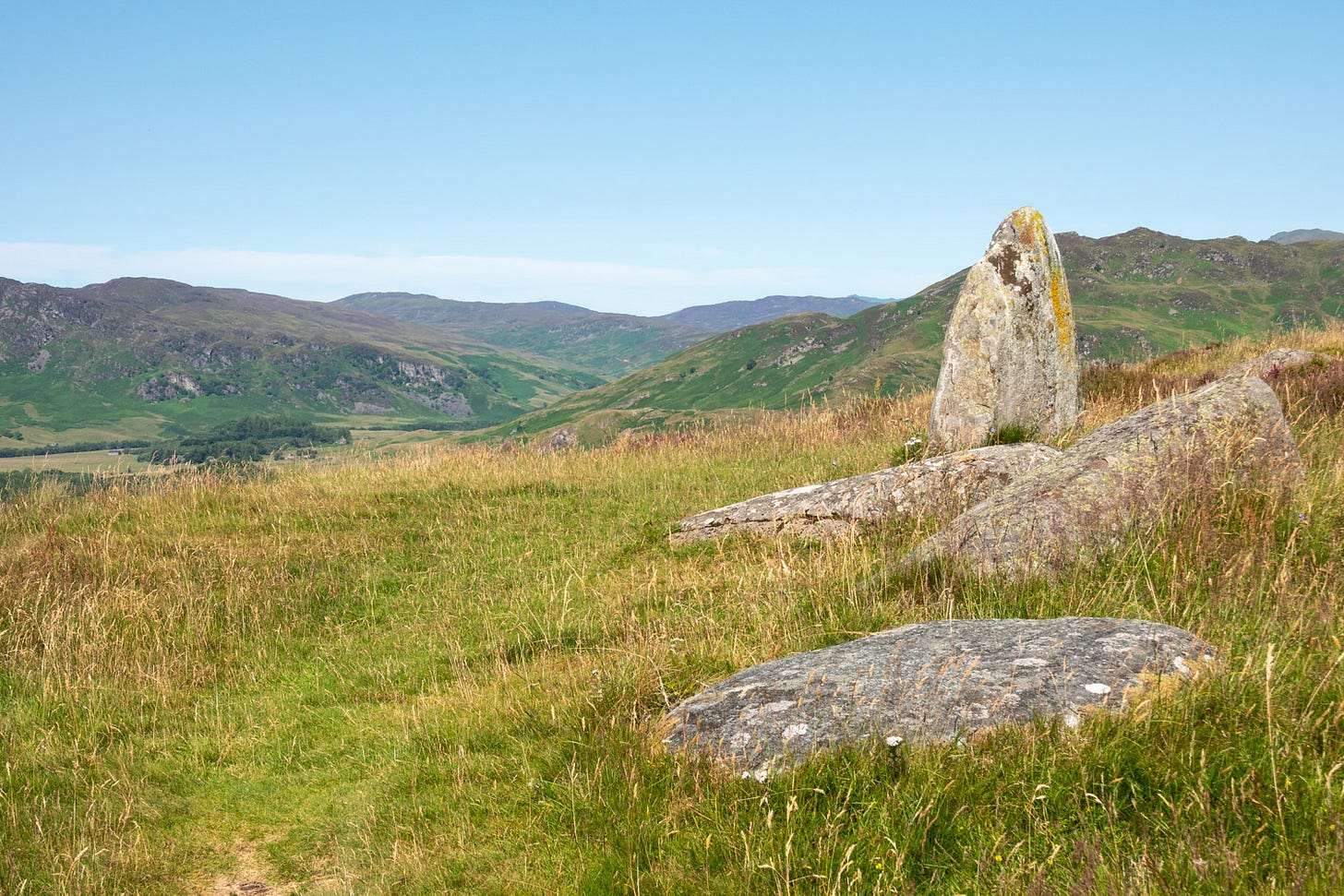
The cultural heritage of Glen Lednock is part of the identity and psyche of the people of Strathearn and of Comrie in particular. Along with Glen Artney, it is their connection to the past, with remains going back as far as Neolithic or Bronze Age at sites such as Balmuick Stone Circle. Painted on the landscape is a picture of how their ancestors lived over the centuries. It is a reminder of a pre-industrial way of life that holds equal fascination for people like me, not raised locally, who discover this heritage through encounters with visible traces scattered across the glen.
Chapter 12 of the EIAR, Cultural Heritage, breaks this whole down into a series of numbered ‘assets’, dismissing their importance, although they are interconnected elements telling the story of our past. Itemising them like this allows the developers to dismiss individual ‘assets’ as Low Sensitivity, whereas it is as a collection that they are significant.
It is easy to get lost in the innumerable Tables, Figures and Appendices attached to this part of the report (if you can even find them). When one does plough through them, it becomes apparent that, by claiming that the effect on individual ‘assets’ is slight, each can be dismissed as negligible. However, taken together as dozens of inter-related shielings, townships, dykes and other archaeological remains, those effects add up to much more.
It is also evident that the effect on several important features is significant (although this is rather lost in the morass). This jumps out at anyone familiar with the area who has looked at the plans, especially the route of the proposed turbine access road through the glen. This access road would devastate the various Historic Landscape Types found here and wipe out many individual heritage assets.
Among the heritage assets precious to me that could be lost or reduced in value, are the old township of Glenmaik (Assets 36-47) and Balmuick stone circle (Asset 265).
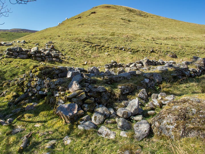
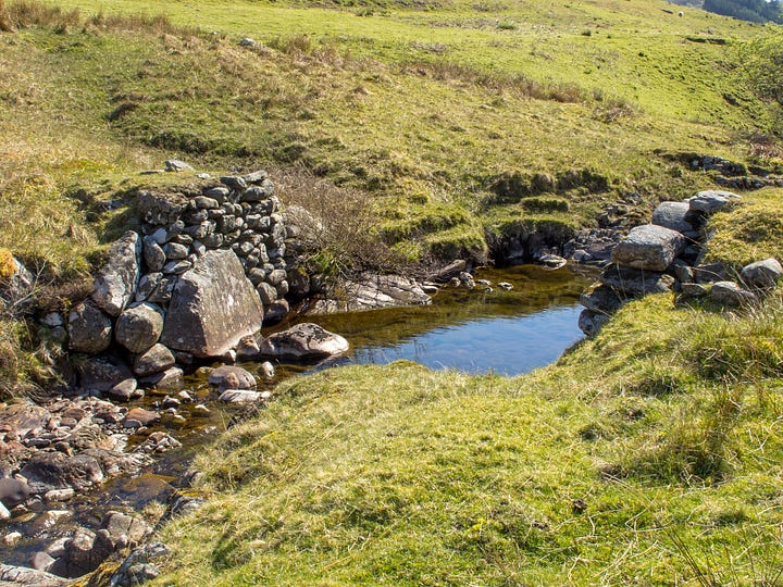
Appendix A12.3a of the EIAR reveals that “Construction of the Access Route Earthworks would permanently remove” parts or the whole of the listed heritage assets that form the Glenmaik township, where the proposed access road follows the Allt Mathaig to the turbine site after leaving the River Lednock. Here the report identifies a collection of ruined buildings, enclosures, rig & furrow systems and clearance cairns, but appears to miss the footing of the ancient bridge that served this community. This township is a wonderful place to visit and be stimulated into imagining the past lives lived here. It would be wanton destruction to drive a major access road through it.
I love to walk or run up to Balmuick stone circle, via various routes available on the east side of Glen Lednock. On arrival I like to take a deep breath and sit on a fallen stone to contemplate its special aura. At its closest point, the proposed turbine access road would run within half a mile of this much-visited hilltop feature. From the stone circle, the glorious view would be spoiled by the scar running up Glen Lednock, leading the eye towards an array of giant wind turbines, looming over the horizon at the head of the glen. (The EIAR estimates that 18 hubs and 19 blade tips would be visible).
There are few places as untouched by time as Glen Lednock. It would be a tragedy to despoil it.
3. Access, Traffic and Transport impact
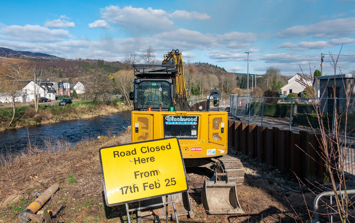
Comrie has been suffering enough from the on-going flood works in the village. The cumulative effect of the proposed wind farm, with much greater construction loads, noise and vehicle movements, would make life intolerable over the next two years.
This section of the EIAR appears to me to disregard many of the impacts, with a proposed route for bringing in turbines, machinery, aggregate and other construction elements that is pie in the sky, unrelated to realities on the ground.
I could write screeds about this, but will pick out some major points and leave the whole issue of recreational access (which the EIAR inadequately addresses) to 4. below.
Firstly I will address the single-track, dead-end road up Glen Lednock, which starts off from the village as Monument Road and higher up is called Glen Lednock Road. Several of the well-used circuits on Comrie Walks leaflet follow this road for part of their routes – usually in places where there is no pavement. Beyond Invergeldie, everyone on foot, bike or horse uses the road to reach Loch Lednock Reservoir, climbing crags, the surrounding hills or the Public Right of Way through to Loch Tay.
I have already had to jump out of the way of vehicles while walking on this road, which has blind bends. In places this is dangerous, because it drops off steeply down to the River Lednock or deep ditches. I have observed a considerable increase in traffic recently with Oxygen Conservation and Low Carbon staff and contractors zooming up and down. I anticipate that this would increase to intolerable and unsafe levels if the wind farm was developed.
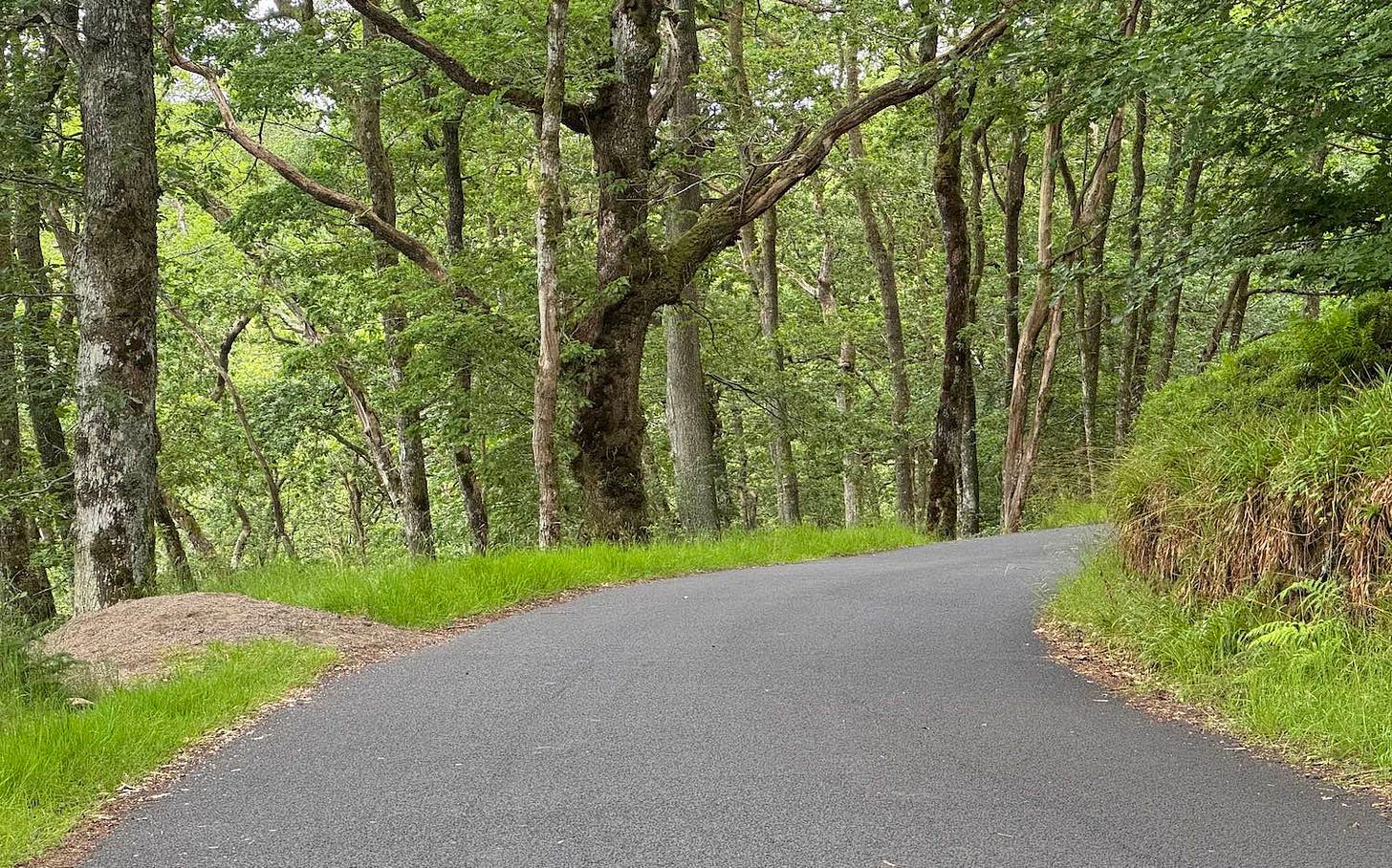
Monument Road weaves through Comrie Woods SSSI, which would likely be damaged by necessary tree lopping and removal. Scottish Water’s Comrie reservoir is located immediately above the road. There is no evidence in the EIAR that checks have been made on the effect that using the road for the initial stages of construction would have on Comrie’s water supply, the SSSI nor the structural integrity of the road itself.
All the additional development traffic accessing Monument Road would come through Comrie village centre, past the Primary School and over the crossing point for pupils to the school.
Moreover, it would be totally unacceptable to Comrie residents and the much wider population who access this area, to have Monument Road closed to the public for eight months, not safely accessible for two years and to have the proposed new access road sever the connections between Comrie and popular routes, including the well used off-road access to Comrie Croft.
The proposed new access road for turbines, from the A85, is planned to cut across virgin countryside and join this road at Funtullich before eradicating many of the features higher up Glen Lednock. There is no engineering information about this access route, which appears to be little more than a desire line on the map. Anyone who has walked all over this land can tell that much of its route would be impossible without mulit-million pound earthworks, because the gradients, slopes and hills, often on the brink of the river or side burns, that would have to be surmounted.
For instance, where PROW: 25/37 from Shaky Bridge to Funtullich (part of the hill track from Comrie to Ardeonaig on Loch Tay) passes the southwest ridge of Ben Chonzie, it is only about 3m wide between a rock face and a steep, wooded drop-off into the River Lednock below. Low Carbon propose to blast the rock away and turn it into a quarry (borrow pit) for road stone, but it is inconceivable that this can be done without a great deal of rock falling into the river. The plan shows this borrow pit site right up to the boundary of the Funtulich SSSI, designated because of its geological importance!
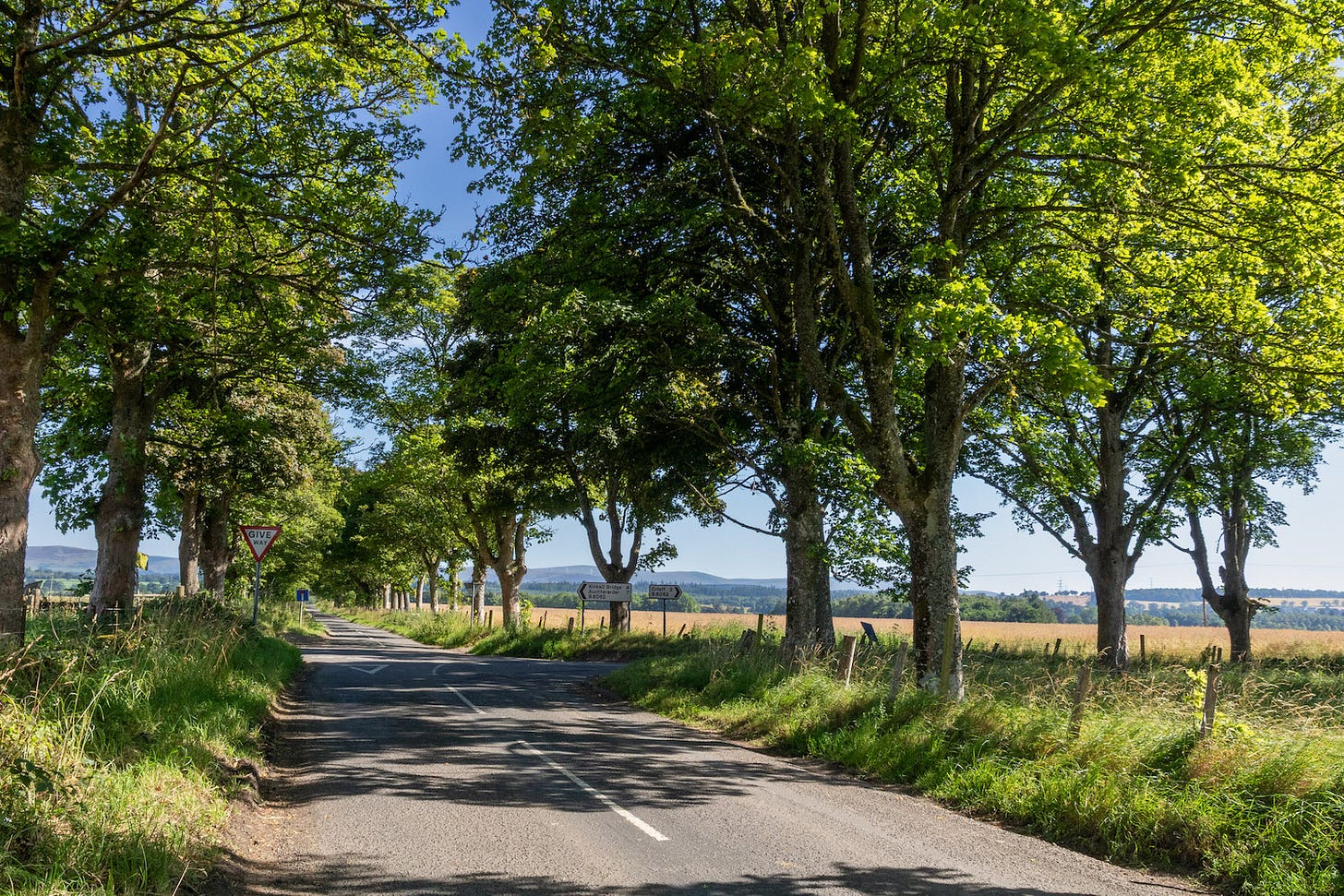
Looking farther afield, the proposed traffic route to bring wind turbines from the A9 to the new access road off the A85 looks equally fanciful and, I suspect has been created as a desk-based exercise. For anyone who drives these roads regularly, it is obvious that wind turbines could not be brought through places that would require too tight turns, without buying up land and re-engineering the course of the road – for instance at the tree-lined crossroads at the foot of Highlandman Loan, southeast of Crieff.
Crieff already struggles with air pollution, which has been recorded above acceptable levels, and this traffic would only make it worse. The suggested route bypassing the High Street would pass the High School, two Primary schools and the town’s supermarkets as well as a considerable area of new housing, some still under construction.
On a wider basis, the felling of trees or removal of all branches overhanging the road, would completely change the rural character of Strathearn.
I believe that the impacts of the proposed access and transport routes should be refused as defined in Policy 14 of NPF4, which states: “Development proposals that are poorly designed, detrimental to the amenity of the surrounding area or inconsistent with the six qualities of successful places, will not be supported.”
4. Socio-Economics, Tourism and Recreation impact
Socio-Economics and Tourism
The ‘great outdoors’ is a fundamental contributor to Perthshire’s economy, no more so than in the scenic rural area of upper Strathearn. People come to walk, climb and bike in our beautiful landscapes, and to experience a closeness to nature that is no longer possible in much of the industrialised central belt. Visitors do not just support 'tourism' businesses, they are also a mainstay of local tradesmen, hotels and B&Bs, restaurants, cafes and shops that give our local economy its vitality.
The EIAR relies on outdated statistics and does not adequately consider the growing importance of eco-tourism and outdoor recreational activities. A more thorough examination of current visitor numbers, demographics, and spending patterns is essential to understand the potential impacts of the wind farm on local tourism.
Negative effects on tourism would be caused by:
the major visual impact of the proposed development and its alteration of a peaceful, traditional landscape brimming with natural elements
the disruption of two years of construction, including closure of the only road up Glen Lednock
the impact on recreational activities (detailed further below).
The overall effect would be like subjecting Comrie to another two years of lockdown, equivalent to the socio-economic losses of the Covid pandemic.
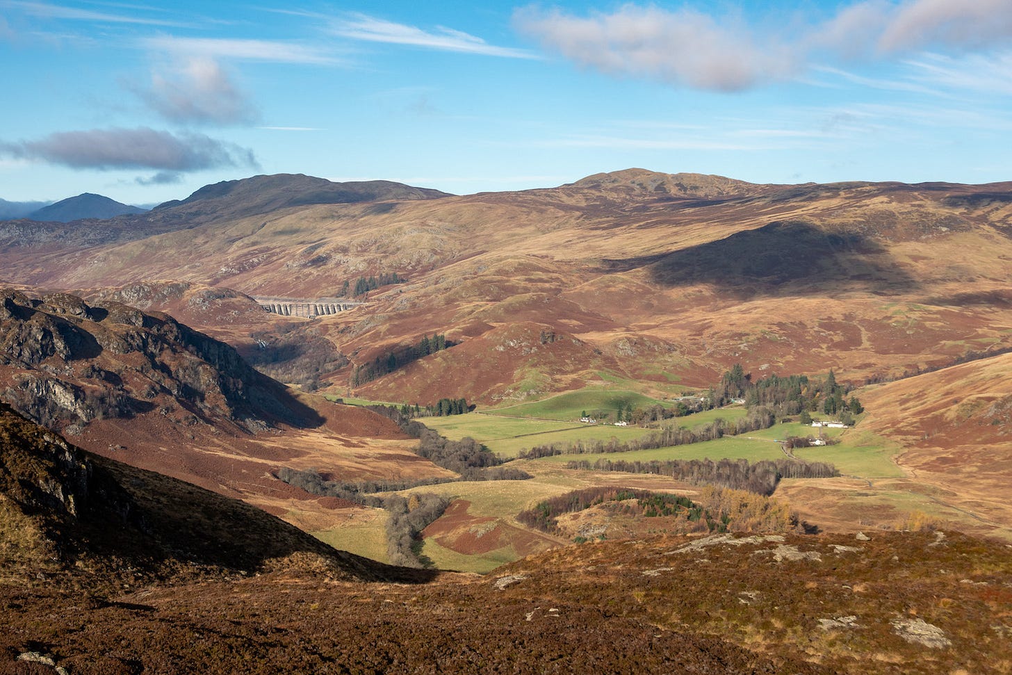
Recreation
Many people have relocated to this area specifically because of the outstanding opportunities to access natural outdoor spaces it offers. That includes me. Over the years I have developed an intimate knowledge and love of the surrounding countryside, which makes me horrified at the shallow nature of the desk-based assessment of impacts. These same outdoor opportunity characteristics attract visitors, who are so important to our local economy.
I find that an important aspect of the recreation experience is not just physical activity, but also the mental benefits of being in a beautiful environment with limitless views of successive ranges of mountains to the north and west, unspoilt by obvious man-made features.
The proposal would destroy the quality of recreational experience over a vast area, not just in Glen Lednock itself. The EIAR scope is too narrow, excluding assessment of impact of recreation in Stirling Council area and Loch Lomond and The Trossachs National Park, where climbing Ben Vorlich or Meall an t-Seallaidh for glorious views over Loch Earn, will be severely impacted. Similarly, it underplays the impact on hill climbs, such as Ben Lawers and Meall nan Tarmachan, to the north, where the quality of Loch Rannoch and Glen Lyon NSA would be compromised.
It also does not consider recreational routes in Strathearn if they are more than 5km from the turbine site. However, many will be affected, for instance:
Cowden Road to Auchingarrich path (PROW 25/6 & CMRI/6), which has a glorious view from Bogton Braes over the village to the Highlands and high ground around Glen Lednock
Auchingarrich via Barr Dubh to Strowan-Balloch Road (CMRI/104), which has similar views as it skirts the flanks of Torlum Hill
in addition many self-designed routes will be affected, such as a favourite walk of mine along the ascending, knobbly southwest ridge of Glen Lednock.
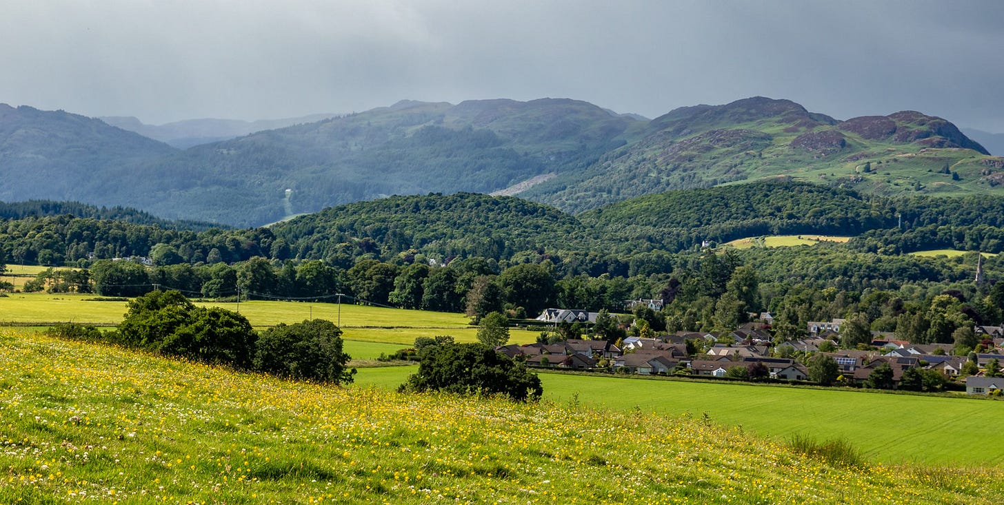
Within the proposed development. it fails to identify and assess the impact on a number of Core Paths and Public Rights of Way:
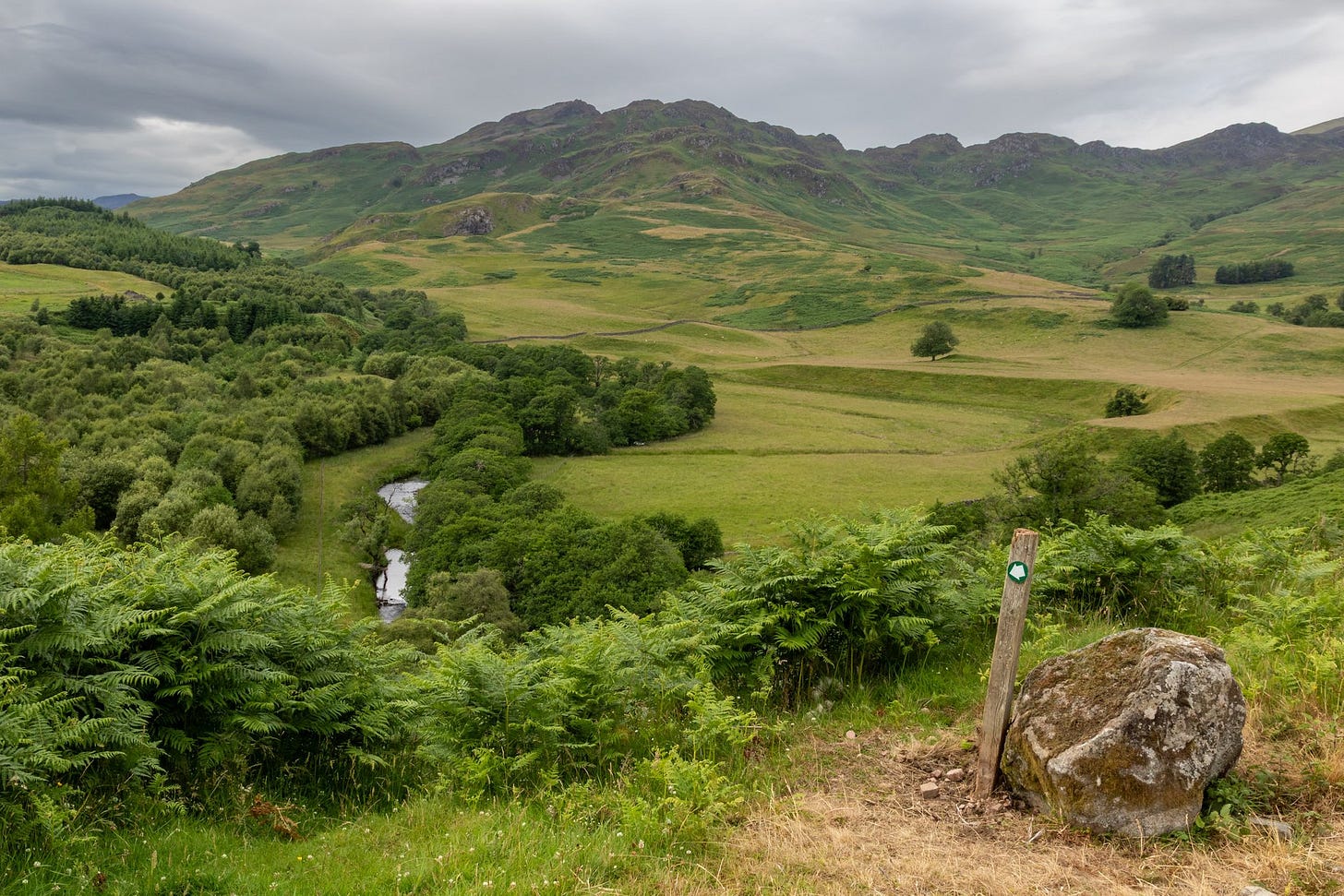
Shaky Bridge to Funtullich: PROW: 25/37 – this glorious grassy path/track far from the public road would be obliterated by the planned access road up the east side of Glen Lednock
the Milton to Glen Lednock via Balmuick and Shaky Bridge: CMRI/36 and ROW: 25/36 – this lies within 200m of the planned access road
path from CMRI/9 in Laggan Wood to CMRI/36 at Shaky Bridge: CMRI/8 and ROW: 25/8 – this lies within 400m of the planned access road and is the east part of the Glen Lednock Circular
Nor does the EIAR identify paths adjoining or using Monument Road that would be affected by the construction vehicles and contractors developing the wind farm. These are:
Monument Road via Deil's Cauldron to Monument Road below Melville's Monument: CCMRI/7 and PROW: 25/7 – part of Glen Lednock Circular using Monument Road for over half a mile
Lord Melville's Monument. Path from Monument Road opposite CMRI/7 to CMRI/18 via Monument: CMRI/53 and PROW: 25/7 – an iconic location and superb viewpoint
Glen Lednock road at Pollyrigg Wood to Maam Road at Cluan Wood: CMRI/19 and PROW 25/19 – this is part of a circular walk that follows Monument Road down into the village
In 14.4.17 the EIAR states: “As shown on Figure 14.1, there are other Core Paths around Comrie and St. Fillans, within 5km of the proposed WTG locations.” These include:
Maam Road. A85 at Kindrochet, passing north of Dunira, to Glen Lednock road north west of Monument: CMRI/18 and PROW 25/18 – an important connection from Monument Road
Section In 14.5 of the EIAR covers Recreation, but fails to detail the impact the proposed development will have on recreation routes. Quite falsely, it concludes, “the effect of construction and operation activity associated with the Proposed Development on the Perth and Kinross economy was assessed as negligible, which is not significant in terms of this EIA.” This totally ignores the importance of recreation in bringing visitors to the area.
There is a risk that recreational activity, vital for the physical and mental health of Strathearn residents and visitors, would be compromised by the curtailing of access due to wind farm construction over at least two years and by a permanent change to the nature of the landscape by the addition of 19 giant turbines (or possibly 31 with Glentarken) to the high ground on the west side of the glen. These are likely to deter future access, particularly to landscapes in close proximity to the wind turbines.
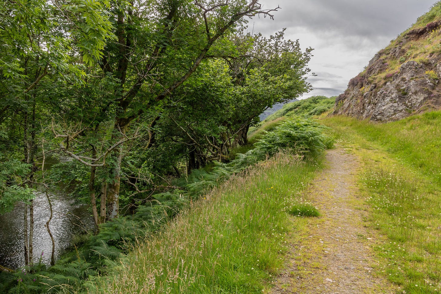
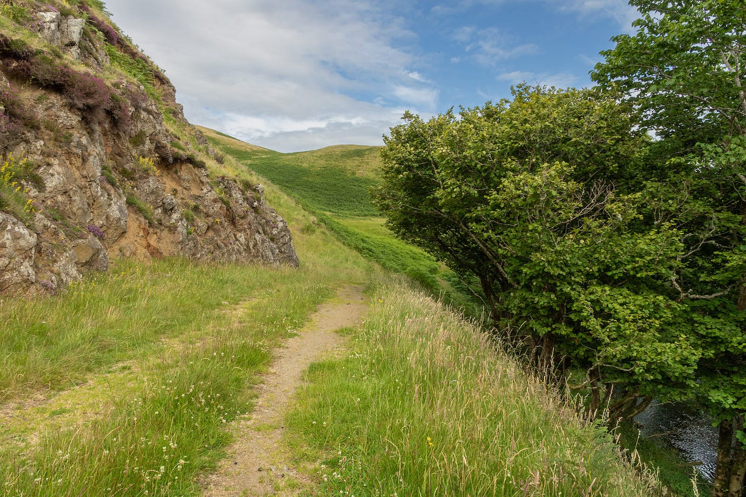
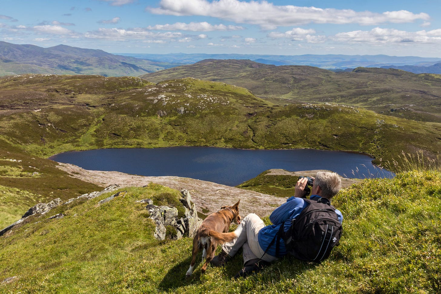
I offer to take any decision-makers considering this application to join me on a walk in Glen Lednock. I would take them on the grassy track that runs from Shaky Bridge to Funtullich (PROW: 25/37, pictured below), which will be destroyed by the access road. It passes through one of the finest and most peaceful landscapes in Scotland.
5. Ornithology impact
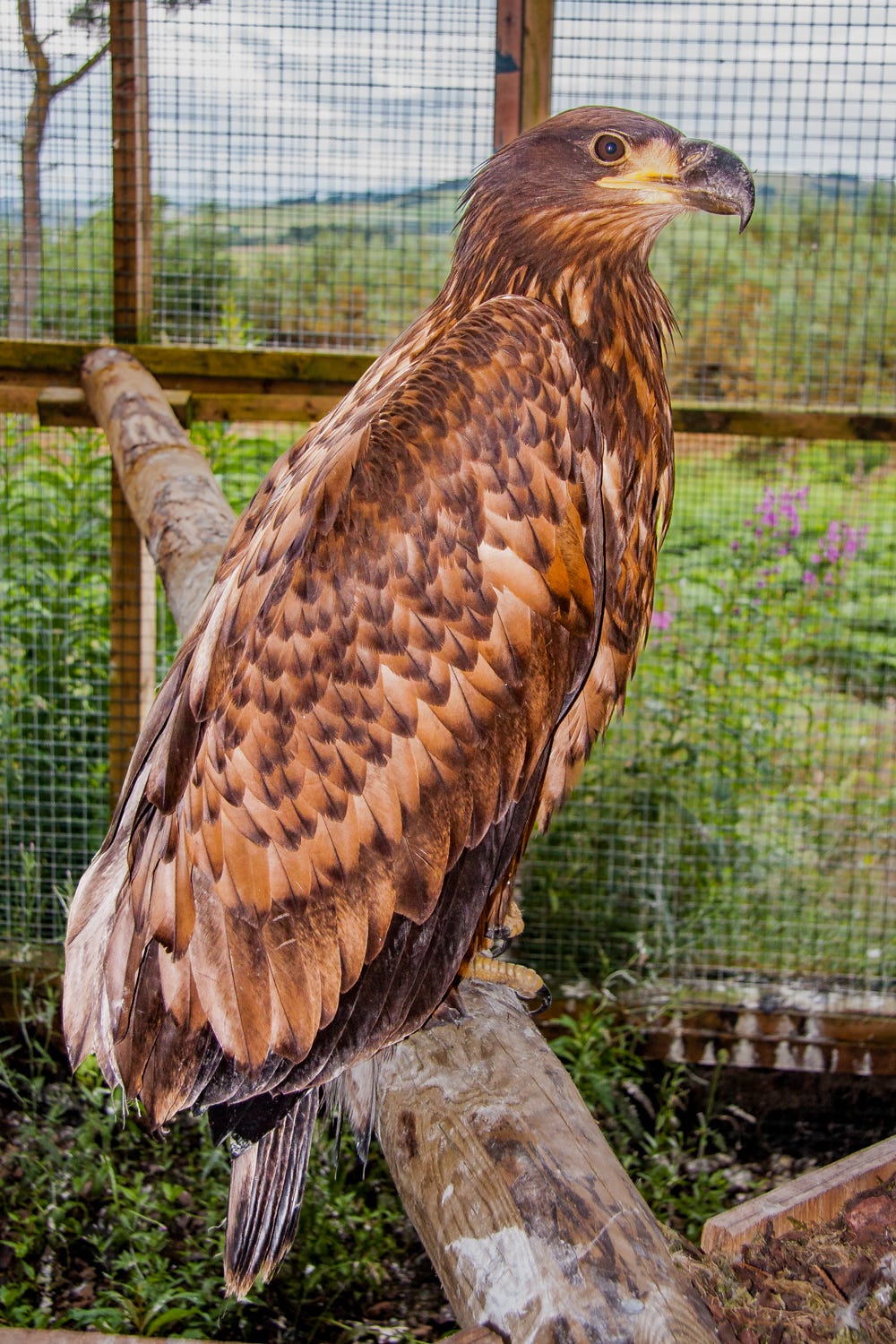
The ornithological assessment in the EIAR turns birds into numbers and treats them as unimportant individually. It seems to take the approach that – so long as they don’t wipe out whole species – it doesn’t matter how many you kill. Personally, I value every Golden Eagle, White-tailed Eagle, Red Kite, and wader that inhabits Glen Lednock and do not consider them expendable.
The assessment does not consider the suffering eagle or kite chicks left starving on the nest because their parent has been killed while hunting. Nor the extra losses this would entail.
The ornithological modelling estimates that over the 40-year lifespan of the wind farm, turbine collisions would result in the deaths of (rounded to the nearest whole number):
14 Golden Eagles
18 White-tailed Eagles
122 Red Kites
That is in one, relatively small area, approximately 3 miles by 2 miles. If anything like those losses were occurring on a shooting estate, the public would be up in arms and the police would be investigating for wildlife persecution crimes.
6. Ecology impact
The proposed development would affect not only the turbine site but also an 8-mile corridor through Glen Lednock, cutting the a swathe through a landscape that has seen little change in the past 200 years. Both the extensive network of tracks to access individual turbines and the access road through the glen would fragment the various vegetation types found here and the habitats for plant and animal communities.
I am a member of Butterfly Conservation and regularly do butterfly surveys elsewhere in Perthshire, so wish to comment particularly on invertebrates that I am used to observing.
It is very disappointing that the EIAR makes no mention of butterflies on the access route and contains suspect information about them in the turbine site. It dismisses invertebrates generally as ‘non-significant’ because widespread suitable habitat for these species in the wider landscape”. However, the area within application site contains some of the best habitat for invertebrates, including some rare and listed species.
In particular, the Pearl-Bordered Fritillary butterfly, which is endangered and on the UK Biodiversity Action Plan as a species requiring conservation action, was recorded within 50m of the planned access road in 2016.
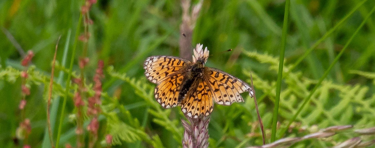
On a recent walk along the route of the proposed new access road, I saw (despite it being a dull afternoon and poor weather for recording butterflies): Small Pearl-Bordered Fritillary, Dark Green Fritillary, Meadow Brown, Common Blue, Small Heath, Ringlet and Green-veined White butterflies. Several of these are high priority for conservation. The meadows that would be bulldozed for the new road contained numerous thyme-covered domes of Yellow Meadow Ants' nests and a Golden-ringed dragonfly flitted around Lurg Burn, whose banks would be destroyed by the access road coming steeply downhill from above.
7. Geology, Hydrology and Hydrogeology impact
The planned access road cuts through two SSSIs, designated for their geology. Both Fintulich SSSI and Craig More SSSI contain what NatureScot describes as, “excellent exposures of a large body of igneous rock (rock formed through the cooling of molten rock, or magma) called the Comrie Pluton, which is about 400 million years old”.
NatureScot’s Objectives for Management (and key factors influencing the condition of natural features) are:
To ensure that the rock outcrops throughout the site are maintained in their present intact, exposed and accessible condition by:
(1) Monitoring the natural regeneration of trees;
(2) Ensuring rock outcrops are not obscured eg as a result of tree planting or
dumping of material.
Blasting of the rock on or adjacent to these SSSIs appears incompatible with maintaining their integrity, especially as the plan is to dump peat dug form the turbine site into the proposed quarry (borrow pit) on the edge of Fintulich SSSI.
Moreover, public access to both SSSis would be curtailed for a period of two years during construction of the proposed wind farm, because the turbine access road crosses these areas.
I hope NatureScot strongly object to the damage to the proposal, which will place these SSSIs in ‘unfavourable’ condition.
Much could also be said about hydrology, but here my main concern is pollution from sediment. The proposed new tracks and access route cross innumerable little watercourses, as well as running along the banks of Allt Mathaig, Lurg Burn and the River Lednock, all of which require bridging. Ultimately, this sediment would wash into the River Earn, damaging aquatic life and fishing interests.
8. Noise and Vibration impact
I moved to Comrie from lower Strathearn, partly because I was being affected by external noise at home. Now I am having to live with the noise of the Comrie Flood Prevention works. I fear the additional noise that would be created by hundreds more HGV movements through the village and by rock blasting up Glen Lednock.
The noise nuisance would also affect all communities between Comrie and the A9, especially those of Methven, Gilmerton and Crieff, who would also have to put up with all the turbine parts rumbling past their doors.
9. Climate Change impact
I am dismayed that the development of the Glen Lednock Wind Farm would lead to the permanent loss of 39.5 hectares of peatland, including 14.7 hectares of priority peatland habitat and 4.8 hectares of montane bog (Appendix A7.3 – Outline Peat Management Plan).
A much better plan for helping reduce climate change and atmospheric carbon, would be to restore the peatland on the turbine development site. This has been degraded by drainage and muir burn and could absorb vastly more carbon if restored.
The EIAR proposes suspect practices, such as dumping peat into borrow pits. Not only is this environmentally unsound, it is also sheer madness to expect damaged and unstable peat to stay in place when placed in rock quarries above access tracks.
Conclusion
My objection is based on the impact on landscape, nature and people.
Residents of and visitors to Comrie are already suffering enough with three years of flood prevention work which is urbanising the heart of their conservation area. Add to this the closure of Comrie most popular walking and mountain biking routes, including the Glen Lednock Circular and Ben Chonzie and the effect would be like another two years of Covid lockdown.
The Energy Consents Unit must refuse consent for the Glen Lednock Wind Farm application. If it does not reject the proposed development, the public can have no faith in what will be a discredited National Planning Framework Four (NPF4) centralised planning system.


It’s the colonial lordship of ‘all is mine’ and ‘how the Wild West was won’ theme with the ‘white man rule’ of Oxygen and Low Carbon. The ‘peasants’ can ‘eat cake’.
Craig Cunningham (Low Carbon), sneered at my suggestion about a community archaeological dig at the Townships, after asking what could be done to ‘appease the community mood about the proposed development…’ Drove roads are up there too. Not to forget the dam and the hydro scheme from the dam (constructed with the Shaky Village in mind and the HBF), that traverses through the hills to Dalchonzie and St Fillans.
I grew up here. The glens were, still are, our forays of getting out of the village for a few hours, albeit they are so much busier now. An escape to a beautiful, sense of place. It makes me weep at the callous disregard and disrespect these corporate companies have, Balfour (butcher) beatty included by destroying our riverscapes, landscapes, environmental-scapes, pastscapes of memories and our lives.
All for corporate greed.
Thank you for all the work you have put in to highlighting what this scheme is really all about. Speaking truth to power is becoming increasingly difficult and I wish you every success with it.