Discovering hidden history in a magical Scottish landscape
From a Palladian mansion and deserted township to a prehistoric stone circle
This is the first post where I have recorded a VoiceOver for those who would prefer to listen rather than read my words.
When you walk through a landscape it adds so much to the experience if you engage with the place and let it trigger trains of thought. That’s what happened when – before leading my walking group around it – I recced the route where I shot last week’s video post.
Although mid winter, with no wildflowers or breeding birds to divert me, I found so much to fire my imagination, especially in the history of the place, which I researched beforehand.
In the headline above I describe this as a magical Scottish landscape. It is, but that doesn’t imply that all the country’s landscapes aren’t magical in some way, even ones that have suffered considerable abuse, such as the oil shale bings of West Lothian where rare wildflowers are colonising a poisonous environment. You just have to look beyond superficial impressions and connect with the undercurrents of natural processes to see the magic. I think you also need to allow yourself to step beyond the logical, scientific framework accepted as reality these days, to sense the vibrations of how places have been in the past, or may be in the future.
That’s what I did while walking alone – something it was much harder to do when revisiting ten days later with a group of walkers, who were so busy chatting that most would probably be unable to retrace the route we took!
The thread running through this outing was human history. I consider that to be a form of natural process, because our species is a part of nature and a major architect of how the natural world appears and functions today. It’s just that our works have been far greater and more widespread than that of any other animal, even the beaver that is so efficient at creating wetlands. The only other non-human forces to compare are geological: volcanoes, earthquakes and continental drift.
In the rest of this post I will share information that I have learnt about places I explored, but I won’t limit myself to the bald facts. I will include my musings of the people who lived here and what they felt about their lives; how they spoke to me across the centuries.
Lawers
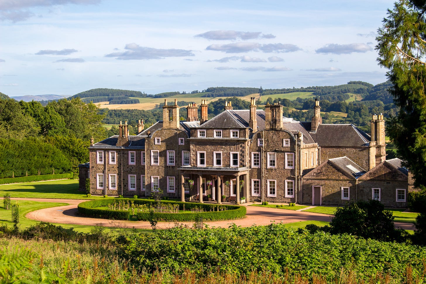
If you have over £3 million available to buy a mansion house with 75 rooms, including 16 bedrooms and a ballroom with a stunning restored ceiling mural, I am afraid you are too late. At the time of writing Lawers House in under offer. The purchaser will acquire three other houses, a walled garden, swimming pool, tennis court and a private pond with boathouse.
This grand house is 300 years old, having been designed by the famous architect William Adam and constructed in two phases from 1724-44. It was built for Lt.-General the Hon. Sir James Campbell MP (1680-1745), who is said to have only slept one night in the finished building before he was killed at the Battle of Fontenoy in 1745 during the Wars of the Austrian Succession.
I guess that the massive old sweet chestnut trees, which I called Ents in the video, were planted at the time the house was being built. They certainly look as if they could be 300 years old.
In 1814 David Williamson, Lord Balgray, acquired the 35,000-acre estate by marriage to his cousin oddly-named Miss William Boyd Robertson, known as Wilhelmina. Under their ownership, the architect Richard Crichton greatly enlarged the house, adding a clocktower and moving the main entrance to the north side, where the drive ends in a large turning circle. The size and grandeur of the house would have been a powerful statement of the family’s social status.
Can you see a line of carriages sweeping up the driveway, delivering ladies in flouncy dresses and gentlemen in frock coats to a lavish ball? Their grooms and drivers retire for the evening to the stables and servants quarters in the courtyard, while inside chandeliers with thousands of flickering candles illuminate the cotillion and quadrille dancers.
In a later generation of the family, the impressive country estate of Lawers was severely truncated out of spite. Lt.-Col. David R. Williamson fell out with his son and heir Charles when the latter converted to Catholicism. Determined to limit his inheritance, the father began selling off the estate. When Charles returned after his father’s death only 4,000 acres remained, an eight of its former size. He sold Lawers but kept the dower house on the edge of the village and founded its Catholic Church in 1914.
During WWII, an Edinburgh school relocated to Lawers House. Afterwards Perth County Council ran it as an agricultural school until 1973. Its pupils boarded in the house in multi-occupancy bedrooms and worked outside bringing order back to the dilapidated grounds. It subsequently passed back into private ownership and its interiors were refurbished.
When the house went on the market 18 months ago for £6.75 million, the estate had become smaller still, at 644 acres. The flat, fertile arable land lying south of the A85 sold to neighbouring farms, leaving a mere 52.3 acres (21.2 Ha) near the house. What a contraction from its heyday when Sir James Campbell owned a vast area, covering more than 10 square miles. Back in 1724 there would have been dozens of tenants, now only a handful of people live on the estate, all confined to the low ground.
Balmenoch
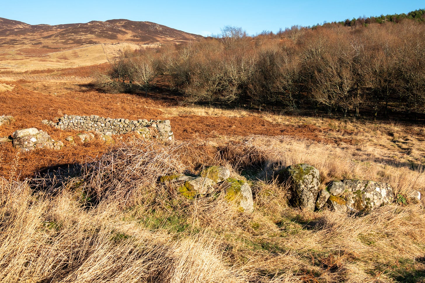
In Gaelic this name is 'Am Baile Meadhnach’, meaning 'the middle farm’. In my video you can only see the low stones of a few ruins, most of which are covered in bracken. It gives its name to the adjacent steam, Balmenoch Burn, which nearer Lawers House cascades over a beautiful waterfall.
When I first walked here sheep grazed and trampled the land, keeping vegetation lower so that the ruins were more visible. The conifer forest on the opposite side of the track stood tall and dark; it has now been felled.
Canmore, Scotland’s National Record of the Historic Environment (see Notes below), described it in 1968 as a depopulated farmstead of ten buildings, a corn-drying kiln and several small enclosures.
Information added in 1998 refers to the 1st edition of the OS 6-inch map (Perthshire 1866, sheet xciv), which depicts a township, comprising ten unroofed building and one enclosure, and a circular unroofed structure annotated 'lime kiln’. The online catalogue includes an aerial photograph from 1991, showing the layout.
The extended family that lived here would have practised subsistence farming, keeping cattle, horses and a few sheep and goats, that were grazed in summer on higher, rougher moorland. They would have cut hay for fodder from damp pastures and grown ‘corn’ (probably oats or barley) on the better ground, which was fertilised with the dung of wintering animals and possibly lime from a kiln. They would have been largely self sufficient and, before the cash economy developed, would have paid their rents ‘in kind’ by supplying food products to the landlord.
Balmenoch inhabitants had neighbours, with another township higher up at Braefordie and others on the now deserted, rolling upland that ranges from 150m to 300m, with heathery mountains rising more steeply above.
This was a peopled landscape, alive with the voices of children herding livestock and adults helping each other with harvest. But modernity, especially the Enlightenment, wrought changes. Landlords wanted to increase rents to fund their lifestyles in Edinburgh or London, where many now spent most of their time. Small tenants came under pressure to pay higher rents and eventually had their tenancies terminated so the land could be turned over to more profitable sheep.
Canmore states that the site was probably depopulated in the mid 19th century, but I suspect it happened in the early 1800s, as considerable change is reflected between the two Statistical Accounts of that era (see Notes below). Balmenoch would have been in the parish of Monivaird (sic) and Strowan, but reports from the adjacent parish of Comrie paint the picture.
Dating from 1838, the New Statistical Account of the Parish of Comrie records what had happened since the Old Statistical Account was written in 1795. Rev. William Mackenzie, the minister charged with writing it, reports:
“The improvements made recently in the parish consist of drainage, enclosures, the erection of suitable farm-steadings, irrigation, turning useless marshes into profitable hay-meadows, and planting woods.”
The progress he describes was rapid and had a fundamental effect on the inhabitants’ culture and lifestyle, with the abandonment of old Highland ways as they entered a more modern era:
“While the population has continued stationary in amount, it has been changed in two respects; from being resident on farms it has become chiefly resident in villages, and from using the Gaelic it now generally uses the English language. The Highland dress is entirely disused.”
His report is written from the perspective of the landowners, from whom he requested information to complete the account; he doesn’t say what the ordinary people thought about such disruption being wrought on them:
“Proprietors have diminished to one-half, while their rental has quadrupled. The system of small farms has been put down; considerable enterprise has been shown in the improvement of land and stock; by means of green crops and sown crops, a proper system of rotations has been introduced; excellent farming utensils are now in use; capital and skill have greatly increased, so that, instead of farm produce being imported, a good deal is now exported from the parish.”
This development, from subsistence farming to a capitalist economy, wasn’t without its social consequences:
“Wages are doubled, and pauperism has increased fourfold.”
That was the among people who stayed. Many local families in straitened circumstances applied for, and were granted, emigration status with free passage to Canada where they could become landowners in their own right. The only requirement was that they cleared the 50 or 100-acre lots they were allocated and brought them into cultivation over the first five years. In May 1818 there was a mass exodus from Perthshire, with scores of people from Comrie walking on foot to Greenock to board ships that sailed to Quebec, from where they travelled inland to Ontario. In the 20th century Comrie was twinned to Carleton Place, Ontario, where many of their descendants live.
Balmuick Stone Circle
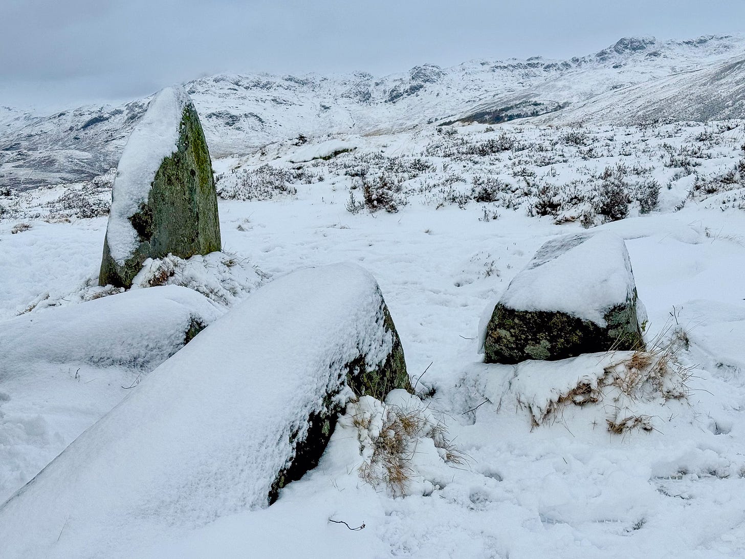
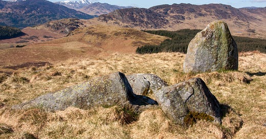
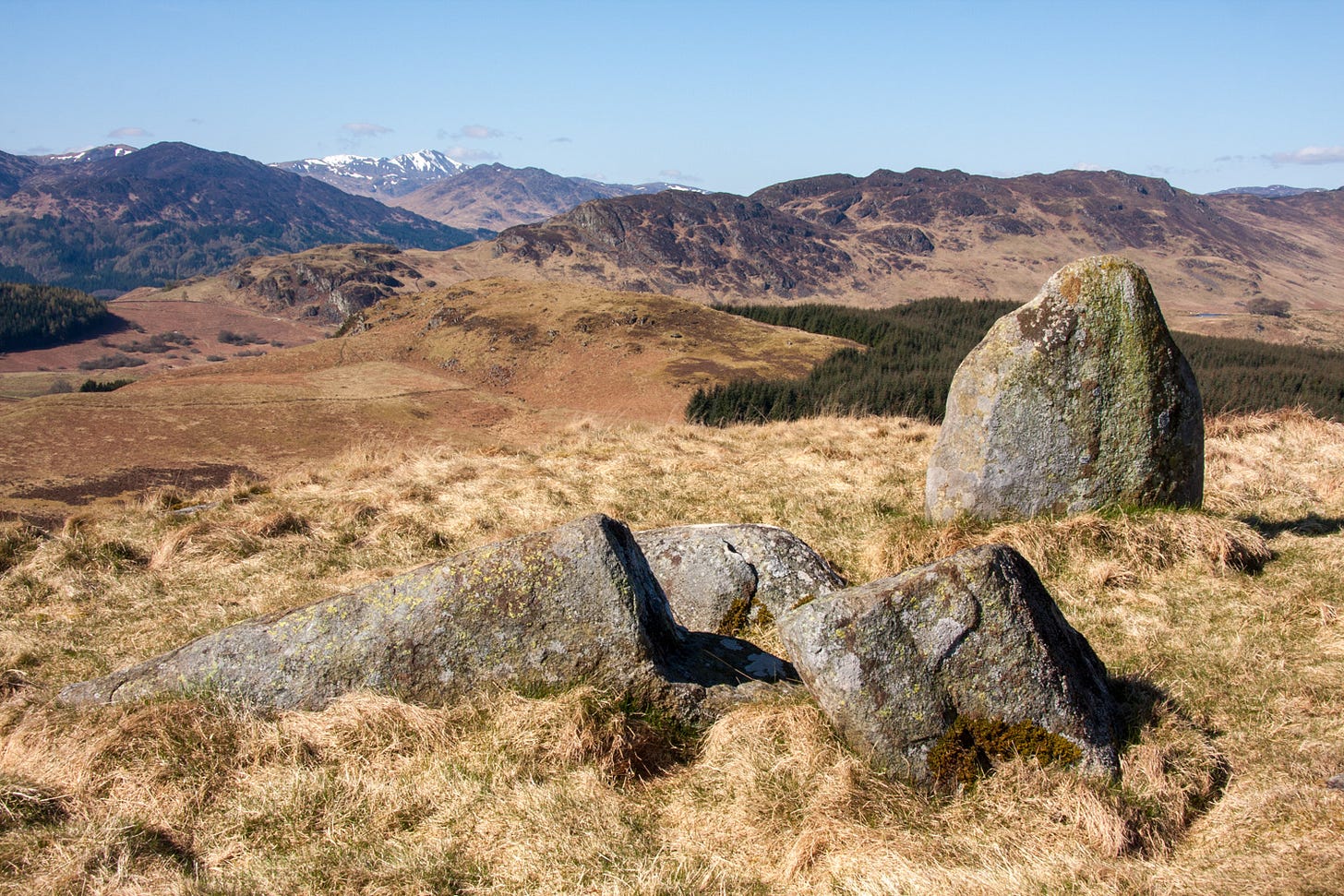
Further on and higher up, perched atop a rounded hill is a cluster of stones that are named after (still inhabited) Balmuick Farm a mile to the west. The people who erected them lived in the Neolithic or Bronze Age and probably had lives that would have been recognisable to the inhabitants of Balmenoch. Maybe they were actually their ancestors?
Six large stones make up the group, only one of them now erect. On Canmore there is some debate over the years as to whether they formed a chambered cairn or a four-poster stone circle, a design found widely throughout Perthshire and Angus. The latter seems more likely, as the smaller cairn stones would have had to be carried quite a distance to be used elsewhere.
The hill is a magnificent viewpoint, with an all round view that includes the Munros of Ben Chonzie to the north and Ben Vorlich to the west. It looks south over green, low-lying Strathearn to the Ochil Hills and beyond to East and West Lomond, volcanic peaks in Fife.
At the northwestern foot of the hill lies a hut circle. Around it is a field system with fifty stone clearance cairns within levelled fields. These early farmers would have cultivated the land using similar methods and crops to the occupants of Balmenoch.
What better location to create your ritual place – on a hilltop where your invocations can rise freely to the gods in the skies? The site hasn’t been excavated and it’s likely that buried deposits may contain artefacts or the bones and ashes of people who held a special place in the community.
Millennia of human influence
Sitting on one of the prostrate stones I try to visualise the landscape as it was when these settlers came and chose this as a place to make their living. Did they replace or merge with the hunter-gather tribes who were here before them?
The land was probably easier to work than the valley bottom, which pre-drainage would have been boggy and thickly wooded. Trees would have grown up here too, but probably interspersed by glades kept open by deer and other grazing mammals. Above this point, the woodland would have become scrubbier, running up to a natural treeline.
These first farmers no doubt brought domesticated livestock with them and, once stones were cleared from the flattest land, they could have grown crops to feed their families and animals. With running water nearby and plenty of wild game they could have led contented lives in a cycle of seasons that remained unchanged for centuries. I wonder what knowledge they had of the natural world that we have lost? Their technologies may seem simple to us now, but at least they had full command of them – unlike us today who rely on machines, such as computers, cars and cash machines, whose workings we don’t understand.
Innovations probably did bring slow change over time, but the basics of life remained the same until the inhabitants of Balmenoch were cleared from their tenancy. In the two centuries since then the pace of change has accelerated, as new ways of making money out of the land are developed.
Sheep, sport shooting and forestry have all featured, with attempts now to turn nature into a capital asset through carbon trading. I will write more about this next time.
This is my longest post to date, since starting Our Natural Place just over a month ago. Did you find it interesting? Was it too long? Would you like more detail like this about places I walk around and explore?
Notes
Anyone interested in Scotland’s places and past will find the sources I use endlessly fascinating. I am always surprised how few people know about these information portals. If you live in the country or are simply visiting, I encourage you to look up a locale that interests you – you will become engrossed in what you find.
Canmore
Canmore is Scotland’s National Record of the Historic Environment, an online catalogue to its archaeology, buildings, industrial and maritime heritage. I make most use of the map search, which allows you to zoom into your area of interest and then click on sites to see what information is held about them.
Historic Environment Scotland
Historic Environment Scotland is a government agency that holds information about listed buildings and designated sites and has a role on planning consents. It also has a map search.
Scotlands Places
Scotlands Places brings together records from Historic Environment Scotland, National Records of Scotland and the National Library of Scotland. I could spend hours exploring its
Maps, Surveys and Plans
Photographs
Archaeological Records
Drawings
Tax Rolls
Ordnance Survey Name Books
Publications
The Statistical Accounts of Scotland
This website contains both the Old and New Statistical Accounts in a searchable format. You can find whole Parish records or search for words and phrases, for instance ‘Lawers’ to see where they occur.




It's lovely to hear your voice, Felicity. I think it's a really good addition to a post because it lets us move around while listening to the words. We're not fixed with eyes to a screen. We can wander and wonder.
Thanks . I enjoyed reading it through with your narration. I think it was a perfect length and very interesting.